


Collection numérisée
Cartes et plans : Le Mans, Sarthe et Maine, XVIe-XIXe siècle
![[img]](http://www.michael-culture.org/fr/4693/1/Cartes_1_ret.jpg)
 Preview |
Titre
Plan de la ville du Mans, par Janvier. 1777
![[img]](http://www.michael-culture.org/fr/4693/2/Cartes_2_ret.jpg)
 Preview |
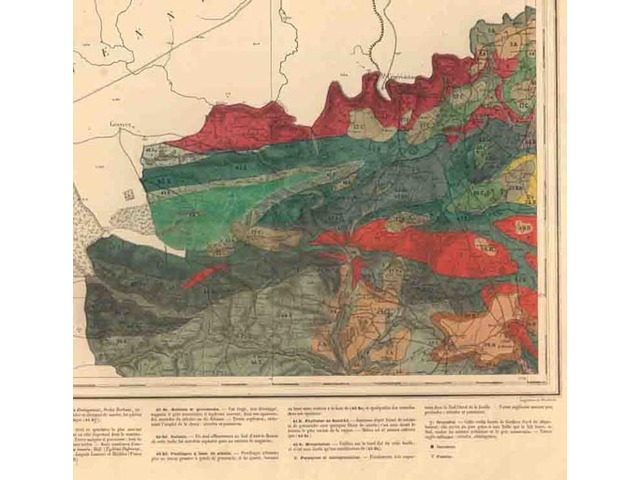
Titre
Carte géologique de la Sarthe par A. Guillier. 1875-1882
![[img]](http://www.michael-culture.org/fr/4693/3/Cartes_3_ret.jpg)
 Preview |
Titre
Diocèse du Mans, par Nicolas Sanson. Après 1648
Actions (login required)
 |
View Item |